


WHEN
12 -15 December 2021
WHAT
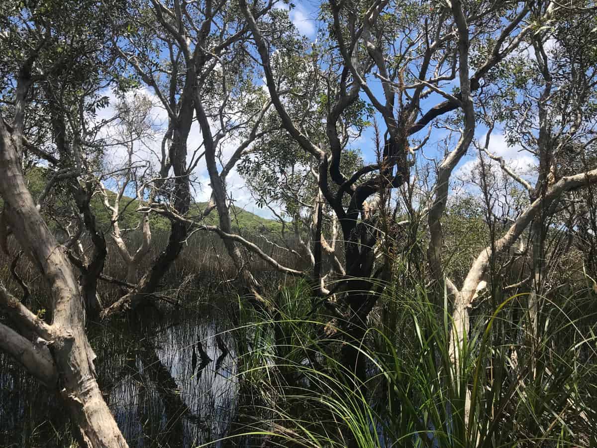
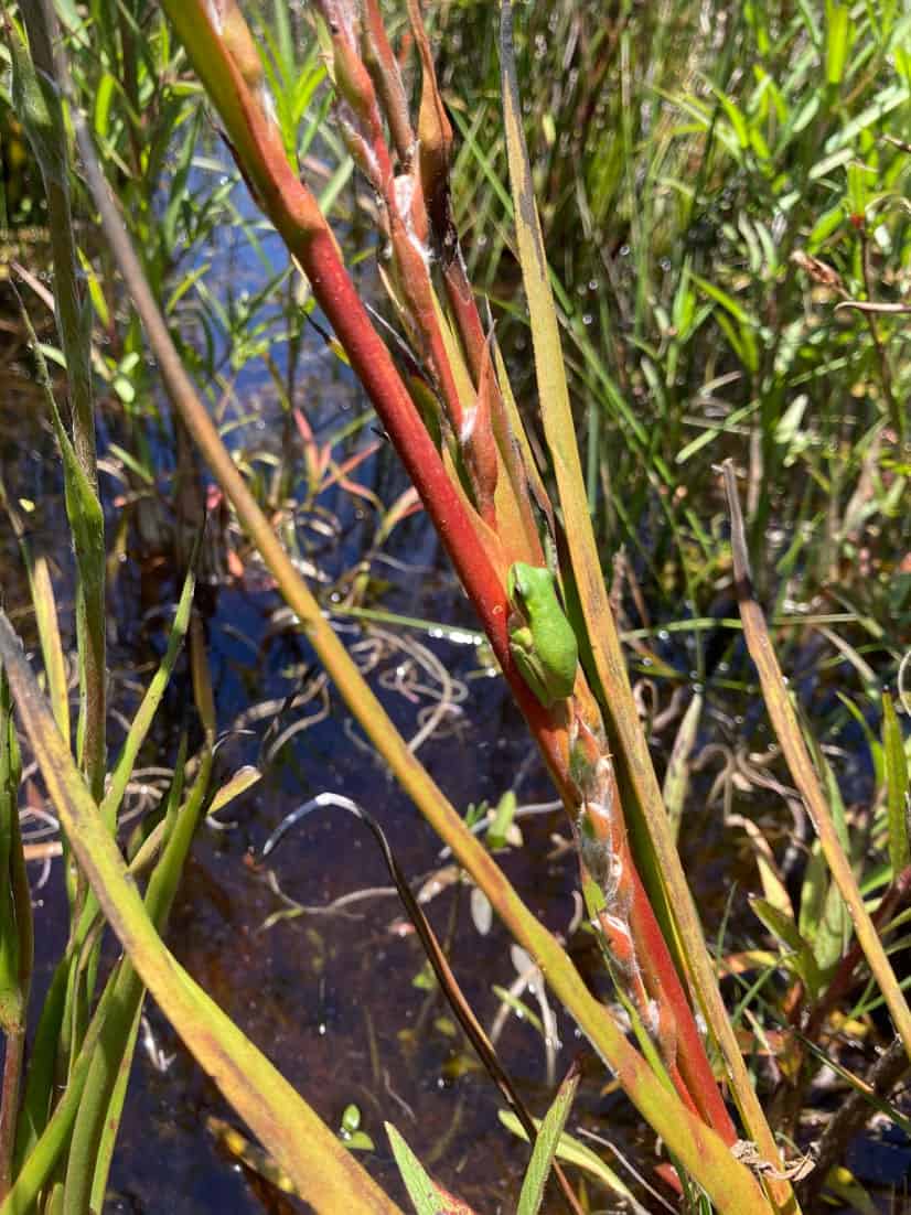
Following our noses into the patterned fens of Minjerribah (also Terrangeri), the Australian research pod began thinking and feeling with the black waters, heath wildflowers, the paperbark trees, Ungaire, spreading rope rush, sundews, a wallum sedge frog and many dragon flies we encountered. Bringing together our experiences as a group that includes Quandamooka lineage, we spent our days ‘swamp witching’ – seeking connections within the peaty ecosystems, to each other and to the stories and histories of Moreton Bay, the traditional lands and waters of the Quandamooka People.
Our new friend and palynologist (one who studies fossil pollen), Dr. Patrick Moss, shared a useful article to introduce us to the uniqueness of the subtropical sand island patterned fen formations. As the article describes, fens are a type of peat forming wetland that are fed mostly by groundwater and are usually dominated by grasses, sedge and rushes. Bogs, like the bodies in Tierra del Fuego, are fed mostly by rain water, have less water exchange, are more acidic, and are often dominated by Sphagnum mosses. Over time, most fens transition into bogs. There are many types of fens and bogs with their scientific names offering clues to where and how they were formed. Patterned fens are formed by peat accumulating at varying rates in different places, leading to a mosaic pattern of flarks (pools of water) or strings (linear stretches of water) and ridges (vegetated risings).1
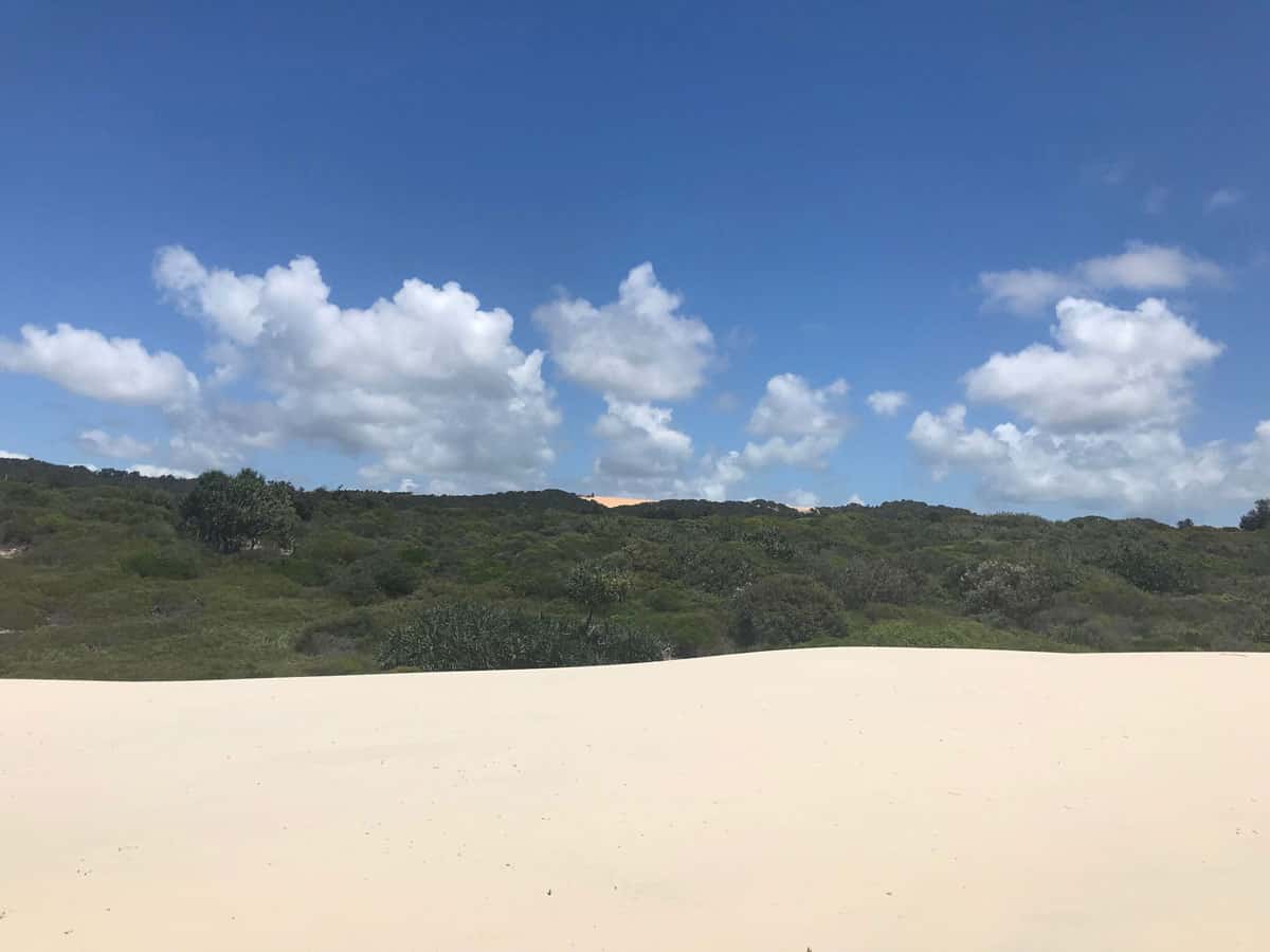
We began our field research in Eighteen Mile Swamp which stretches most of the eastern coastline in Naree Budjong Djara (my mother earth) National Park. The wetland, or swamp, or peatland, or fen, or mire (depending on who you ask), lies in a large sand trough formed over millennia with the rise and fall of the sea. It is protected and nourished by ancient dunes and complex hydrological systems. A large underground aquifer is contained within the sandmass of Minjerribah which feeds into many of the freshwater wetlands and lakes. Karboora (meaning ‘deep silent pool’) is a ‘window lake’ formed by a depression in the sand that exposes the water table. Karboora is one of the most sacred water bodies on Minjerribah and because of its significance to Quandamooka culture, visitors are requested to approach with respect, take time for quiet reflection and not to swim in it.2 Karboora receives a constant influx of groundwater that overflows via a creek into Eighteen Mile Swamp. Despite this intimate relationship between groundwater and surface water, the island’s groundwater is still being piped to the mainland providing at least 60% of Redlands water supply.3
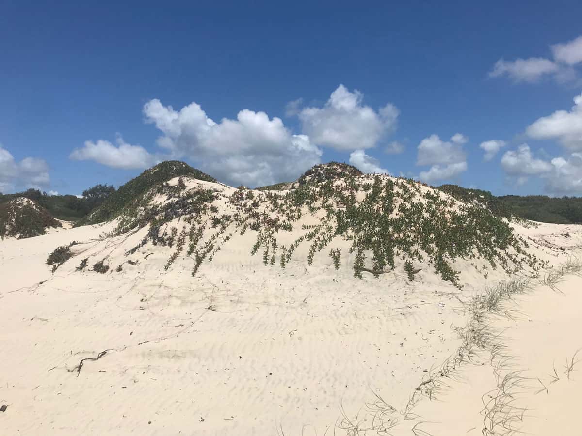
From the beach, we could see distinct scars of a sand mine on the otherwise forested central dune. Following decades of impact studies and protests, the last of the sand mining operations on the island ceased in 2019. With public access still limited, we studied Renee’s satellite geo mapping system to get a sense of the mine’s scale and proximity to the adjacent wetlands. We witnessed trucks moving across the ridge and wondered… ‘Rehabilitation?’. Moving on, we heeded a warning from an eastern brown snake not to enter the scrub beyond the coastal foredunes. Approaching from the west instead, a midden exposed by road cuttings showed us that this has long been a place of abundance and gathering for the Quandamooka people.
At most of the sites we visited over the following days, Sonja showed us the distinct pink and cream hues of Ungaire, a reed and cultural weaving fibre that grows in many of the island’s peatlands. The Carmichael women have been working alongside their family, Elders, and community members on the regeneration of Quandamooka weaving practises. Back at their home, Sonja and Leecee shared how they are each reviving and honouring their heritage and the plant communities of the island through traditional weaving techniques and contemporary adaptations. Freja describes her family’s ancestral connection beautifully in the catalogue accompanying her 2016 curatorial project Gathering Strands at Redland Art Gallery:
For our ancestors, weaving was a way of life. In keeping with the seasons, fibres were carefully harvested and women would sit and twist these reeds to string, and loop, knot, coil and plait them into unique flat bags, beautiful baskets and intricate mats. Food and other important items would be transported in these woven forms. Scents of country would be imbued and physical traces captured within them, symbolising strength in togetherness and the transmission of our rich culture. 4
Caitlin and Renee continued searching for the elusive spreading rope rush (Empodisma minus) which seemed to have been taken over by Paperbark forests, ferns and rushes at the margins of the fen bodies. It wasn’t until Renee’s curiosity for wildflowers and fearlessness of the snake season led us along a shrubby ridge, right into the centre of a wetland. Here the spreading rope rush dominated the edge of a deep black pool. Intermingling within the wiry network of rhizomes, Ungaire stood tall. The spreading rope rush was likely one of the first plants to thrive in early inland pools of mineral rich water on the Moreton Bay and Fraser Coast sand barrier islands. It is thought to have played a key role in transforming these pools into the sites of refuge they are today for rare plants, fish, amphibians, insects and birds.5 It is a highly resilient peat forming plant, meaning it only partially decomposes, accumulates and compacts into layers of peat in the slow moving, almost still, waters of the wetlands.6 It resprouts, impedes drainage, reduces evaporation from the wetland, releases organic acids and, in some contexts, it can inhibit the growth of other plants.7 All of these properties have bestowed Empodisma species a scientific title of ‘ecosystem engineers’8, meaning they collectively have the ability to modify their environment and to create new habitats.
Glynn Carmichael, took us for a walk to Fern Gully Lagoon, a wetland that has sediment cores dating back over 200 000 years. Research, led by Dr John Tibby, suggests that Minjerribah might have provided a significant refuge for plants and animals during the driest and coldest period of the last 100 000 years of Earth’s history. Core samples provided evidence of wetlands on the island since the Last Glacial Maximum – a period between 26 500 to 20 000 years ago when glaciers advanced and sea level lowered.9 The Minjerribah wetlands now provide essential habitat for a vast number of unique threatened species. These include the water mouse (Xeromys myoides), Yellow Swamp Orchid (Phaius bernaysii), the Swamp daisy (Oleris hygrophila), Wallum froglet (Crinia signifera) and the little acid loving frogs that are dependent on the reeds for their existence.10 Considering the ancient past and possible future transitions of the fen bodies, it may be more apt to refer to the Empodisma species as a ‘slow ecosystem engineer’. Perhaps the spreading rope rush is showing us virtues of rest and a different kind of productivity and growth that emerges from deceleration. Bundjalung writer, Melissa Lucashenko declared a similar sentiment in her speech at the 2022 Invasion Day rally, ‘Some of our mob say, rest can be revolution…Not in a selfish way. In a way that we are all something bigger than just ourselves’.11
While peat fires in many locations are cause of great concern because they can release huge amounts of greenhouse gases, it has been suggested that the rhizomes of the spreading rope rush protect the underlying peat from ignition and facilitate post fire regeneration of the fen vegetation.12 Similar to much of the Australian landscape, fire has been a part of fen development on the sand islands for millennia. Dr Patrick Moss met with Ensayos and described how peat core samples are ‘botanical and fire archives’ that can be studied to understand change in vegetation communities and local fire regimes. He noted that Minjerribah has some of the best records from the subtropics of Australia, demonstrating vegetation and moisture presence for over 40,000 years.
The ‘botanical and fire archives’ tell stories of major climatic shifts and human activity. They tell of a transition from frequent low intensity fires linked to traditional fire management practises to lower frequency burns in the post colonial settlement period.13 Existing between the fossilised lines of pollen and charcoal lies a message, where traditional knowledge was being practised there was greater biodiversity. This continues to be understood by the Quandamooka people today who are working, together with fire ecologists, to reinstate regular low intensity burning. The benefits to the health of the ecosystems are clear.
Our last stop before heading back to the mainland was Capembah Creek, named after Capembah, the ‘big hill’ to the south of the creek. The creek is situated within the coastal rainforest to mangrove habitats of Moongalba (sitting down place), also referred to as Myora Springs. The creek is fed by a spring flowing to the mangroves, where saltwater and freshwater meet. We walked with the creek, bordered by finger-like aerial roots, or ‘snorkels’, emerging from the waterlogged peat. The network of Mangrove roots, salty canopy and build up of peat provides a natural barrier for the inland ecosystems, offering protection from storm surge, flooding and erosion. We were presented with a very different scene at Pulan (Amity Point), where recent coastal erosion has encroached into beachside private properties, raising a question – at what point is the land to be given up for the sea?
WHY
Because the Australian Ensayos pod is creating a gift of a scent for our Chilean friends that care for the peatlands of Tierra del Fuego. The scent, to be infused in the Chilean Pavilion of the 59th Venice Biennale, will be inspired by the peat dominated wetlands of Minjerribah and their stories of slow transformation, refuge, fire, ancestral knowledge and healing.
Because South East Queensland continues to experience rapid population growth and tourism is the Island’s major employer. Despite being listed as ‘internationally important wetlands’ under the Moreton Bay Ramsar site, groundwater continues to be extracted from the island. Pollution, altered fire regimes, impacts associated with development and resource extraction and climate change remain as potential threats to the wetland ecosystems.
Because attempting to delineate and classify wetlands is a slippery task. Water and land meet in a variety of ways and when they do, possibilities emerge. In the liminal zone, rest is both death and rejuvenation. In the rhizomatic network of spreading rope rush, linear time loses its power.
Because information about the deep past is in the peat. Whilst scientists are reconstructing past landscapes through pollen fossils and charcoal, the Quandamooka people are remembering, reviving and reimagining cultural traditions and ecological knowledge. Ensayistas submerge their bodies in the black water and sniff out feelings and stories. These are all integral acts towards caring for the fen bodies. Knowledge is the gift that we share with each other.
WHO
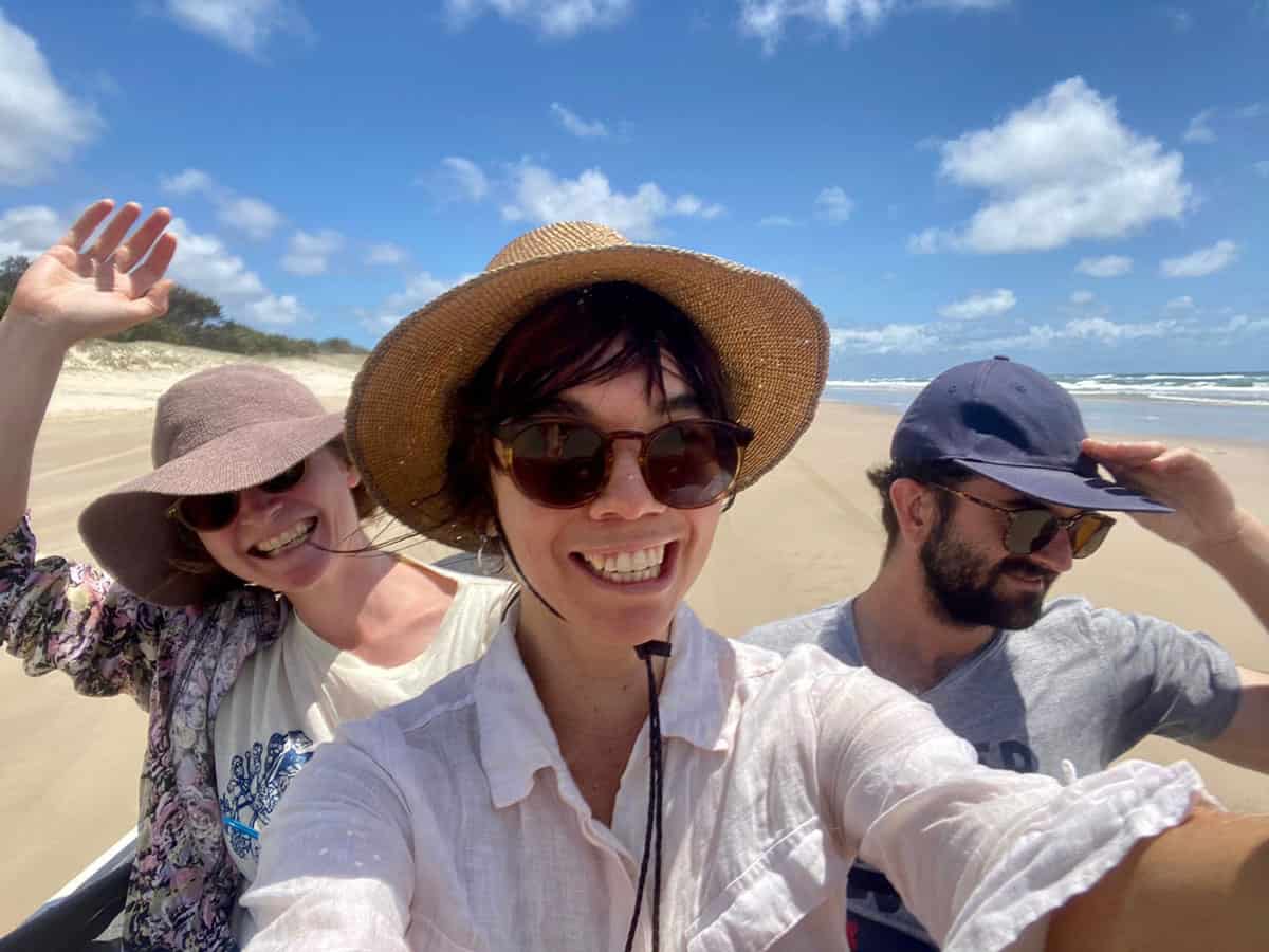
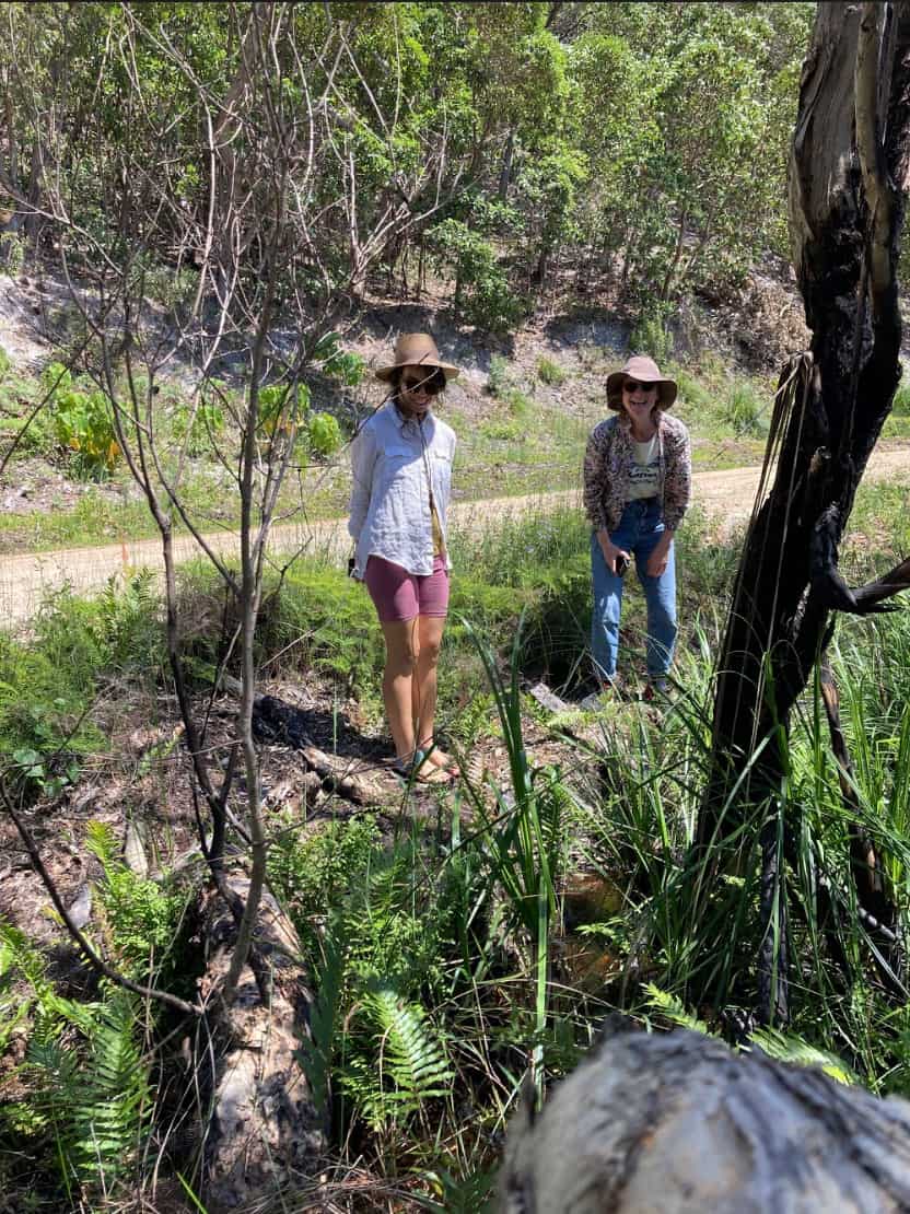
Caitlin Franzmann, Renee Rossini and the Carmichael family – Sonja, Freja, Leecee, Glynn, Jasper and Ira.
HOW
Cruising with windswept hair in ‘Suzi’ (Renee’s 4WD jeep) and through the generosity of our hosts Sonja and Glynn Carmichael.
REFERENCES
- Moss, P. (2014)‘A peaty archive: the patterned fens of the Great Sandy region’. Wildlife Australia, 51 (2), 20-23.
- p.22-23, State of Queensland. (2020) Naree Budjong Djara Management Plan
- SEQ Water. (2019) Planning your water future: Redlands
- p.6, Carmichael. F (2016) ‘Weft and Warp: A Sense of Touch’ in Gathering Strands exhibition catalogue first published 2016 by the Redland Art Gallery, Redland City Council
- Moss, P. et al. (2015) ‘Patterned fen formation and development from the Great Sandy Region’, south-east Queensland, Australia in Marine and Freshwater Research, Volume 67. CSIRO
- McLeod. A. & McPhee. D (2011) Eighteen Mile Swamp Friends of Stradbroke Island
- R. Fairfax & R. Lindsay (2019) ‘The Patterned Fens of Great Sandy Region, Australia’, Mires and Peat, Volume 24 (2019), Article 22, 1–18
- p.7, TA Hodges & GL Rapson (2010) ‘Is Empodisma minus the ecosystem engineer of the FBT (fen–bog transition zone) in New Zealand?’, Journal of the Royal Society of New Zealand, 40:3-4, 181-207
- Tibby, J. et.al. (2017). ‘Persistence of wetlands on North Stradbroke Island (south-east Queensland, Australia) during the last glacial cycle: implications for Quaternary science and biogeography’. Journal of Quaternary Science, 32(6), 770-781.
- McLeod. A. & McPhee. D (2011)
- Lucashenko, M. (2022), Speech delivered at Invasion Day rally , on RadioReversal, 4zzz, aired 27 January 2022.
- Moss, P. (2014)‘A peaty archive: the patterned fens of the Great Sandy region’. Wildlife Australia, 51 (2), 20-23.
- Moss, P. and Stewart, P. (2014) ‘Fire Patterns of South Eastern Queensland in a Global Context: A Review’, presentation for The Large Wildland Fires Conference, Missoula, USA.
CUÁNDO
12 -15 diciembre 2021
QUÉ
Siguiendo nuestras narices hacia los pantanos estampados de Minjerribah (también Terrangeri), la cápsula de investigación australiana comenzó a pensar y sentir con las aguas negras, las flores silvestres de los brezales, los árboles de corteza de papel, Ungaire, los juncos, las droseras, una rana wallum y muchas libélulas que nos encontramos. Reuniendo nuestras experiencias como un grupo que incluye el linaje de Quandamooka, pasamos nuestros días ‘brujeando pantanos’: buscando conexiones dentro de los ecosistemas de turba, entre nosotros y con las historias, y las historias de Moreton Bay, las tierras y aguas tradicionales de la gente de Quandamooka.
Nuestro nuevo amigo y palinólogo (uno que estudia el polen fósil), el Dr. Patrick Moss, compartió un artículo útil para presentarnos la singularidad de las formaciones de pantanos con dibujos de islas de arena subtropicales. Como se describe en el artículo, los pantanos son un tipo de humedal que forma turba y se alimentan principalmente de aguas subterráneas y suelen estar dominados por pastos, juncias y juncos. Los pantanos, como los cuerpos en Tierra del Fuego, se alimentan principalmente de agua de lluvia, tienen menos intercambio de agua, son más ácidos y, a menudo, están dominados por musgos Sphagnum. Con el tiempo, la mayoría de los pantanos se convierten en pantanos. Hay muchos tipos de pantanos y ciénagas con sus nombres científicos que ofrecen pistas sobre dónde y cómo se formaron. Los pantanos estampados están formados por turba que se acumula a diferentes velocidades en diferentes lugares, lo que lleva a un patrón de mosaico de flarks (charcos de agua) o cuerdas (tramos lineales de agua) y crestas (crecimientos de vegetación).1
Comenzamos nuestra investigación de campo en el Pantano de Dieciocho Millas, que se extiende por la mayor parte de la costa este en el Parque Nacional Naree Budjong Djara (mi madre tierra). El humedal, el pantano, la turbera, el pantano o el lodo (dependiendo de a quién le preguntes) se encuentra en una gran depresión de arena formada durante milenios con el ascenso y descenso del mar. Está protegido y nutrido por antiguas dunas y complejos sistemas hidrológicos. Un gran acuífero subterráneo está contenido dentro de la masa de arena de Minjerribah que alimenta muchos de los humedales y lagos de agua dulce. Karboora (que significa “piscina profunda y silenciosa”) es un “lago de ventana” formado por una depresión en la arena que expone el nivel freático. Karboora es una de las masas de agua más sagradas de Minjerribah y, debido a su importancia para la cultura de Quandamooka, se pide a los visitantes que se acerquen con respeto, se tomen un tiempo para reflexionar tranquilamente y no se bañen en ella.2 Karboora recibe una afluencia constante de agua subterránea que se desborda. a través de un arroyo hacia el Pantano de Dieciocho Millas. A pesar de esta íntima relación entre las aguas subterráneas y las aguas superficiales, el agua subterránea de la isla aún se canaliza hacia el continente, proporcionando al menos el 60 % del suministro de agua de Redlands.3
Desde la playa, pudimos ver distintas cicatrices de una mina de arena en la duna central, que de otro modo sería boscosa. Luego de décadas de estudios de impacto y protestas, la última de las operaciones de extracción de arena en la isla cesó en 2019. Con el acceso público aún limitado, estudiamos el sistema de mapeo geográfico satelital de Renee para tener una idea de la escala de la mina y la proximidad a los humedales adyacentes. Vimos camiones moviéndose por la cresta y nos preguntamos… “¿Rehabilitación?”. Continuando, escuchamos una advertencia de una serpiente marrón oriental de no entrar en la maleza más allá de las dunas costeras. Acercándonos desde el oeste, en cambio, un basurero expuesto por cortes de caminos nos mostró que este ha sido durante mucho tiempo un lugar de abundancia y reunión para la gente de Quandamooka.
En la mayoría de los sitios que visitamos durante los días siguientes, Sonja nos mostró los distintivos tonos rosa y crema de Ungaire, una caña y fibra de tejido cultural que crece en muchas de las turberas de la isla. Las mujeres Carmichael han estado trabajando junto con su familia, ancianos y miembros de la comunidad en la regeneración de las prácticas de tejido de Quandamooka. De vuelta en su hogar, , Sonja y Leecee compartieron cómo cada uno está reviviendo y honrando su herencia y las comunidades de plantas de la isla a través de técnicas de tejido tradicionales y adaptaciones contemporáneas. Freja describe maravillosamente la conexión ancestral de su familia en el catálogo que acompaña a su proyecto curatorial de 2016 Gathering Strands en Redland Art Gallery:
Para nuestros antepasados, tejer era una forma de vida. De acuerdo con las estaciones, las fibras se cosechaban cuidadosamente y las mujeres se sentaban y torcían estas cañas para enhebrarlas, anudarlas, enrollarlas y trenzarlas en bolsas planas únicas, hermosas canastas y esteras intrincadas. Los alimentos y otros artículos importantes se transportarían en estas formas tejidas. Los aromas del país estarían imbuidos y las huellas físicas capturadas dentro de ellos, simbolizando la fuerza en la unión y la transmisión de nuestra rica cultura. 4
Caitlin y Renee continuaron buscando el escurridizo junco de la cuerda que se extendía (Empodisma minus) que parecía haber sido tomado por bosques de Paperbark, helechos y juncos en los márgenes de los cuerpos pantanosos. No fue hasta que la curiosidad de Renee por las flores silvestres y la intrepidez de la temporada de las serpientes nos llevaron a lo largo de una cresta de arbustos, justo en el centro de un humedal. Aquí, el torrente de cuerdas que se extendía dominaba el borde de un profundo estanque negro. Entremezclándose dentro de la nervuda red de rizomas, Ungaire se mantuvo erguido. La fiebre de la cuerda que se extiende fue probablemente una de las primeras plantas en prosperar en las primeras piscinas interiores de agua rica en minerales en las islas de barrera de arena de Moreton Bay y Fraser Coast. Se cree que desempeñó un papel clave en la transformación de estos estanques en los sitios de refugio que son hoy en día para plantas raras, peces, anfibios, insectos y aves.5 Es una planta muy resistente que forma turba, lo que significa que solo se descompone parcialmente, acumula y se compacta en capas de turba en las aguas de movimiento lento, casi quietas, de los humedales.6 Rebrota, impide el drenaje, reduce la evaporación del humedal, libera ácidos orgánicos y, en algunos contextos, puede inhibir el crecimiento de otras plantas.7 Todas estas propiedades han otorgado a las especies de Empodisma un título científico de ‘ingenieros de ecosistemas8, lo que significa que colectivamente tienen la capacidad de modificar su entorno y crear nuevos hábitats.
Glynn Carmichael, nos llevó a caminar a Fern Gully Lagoon, un humedal que tiene núcleos de sedimentos que datan de más de 200 000 años. La investigación, dirigida por el Dr. John Tibby, sugiere que Minjerribah podría haber proporcionado un refugio importante para plantas y animales durante el período más seco y frío de los últimos 100 000 años de la historia de la Tierra. Las muestras de núcleo proporcionaron evidencia de humedales en la isla desde el Último Máximo Glacial, un período entre hace 26 500 y 20 000 años cuando los glaciares avanzaron y el nivel del mar bajó.9 Los humedales de Minjerribah ahora proporcionan un hábitat esencial para una gran cantidad de especies amenazadas únicas. Estos incluyen el ratón de agua (Xeromys myoides), la orquídea amarilla del pantano (Phaius bernaysii), la margarita del pantano (Oleris hygrophila), la rana Wallum (Crinia signifera) y las pequeñas ranas amantes del ácido que dependen de las cañas para su existencia.10 Considerando el pasado antiguo y las posibles transiciones futuras de los cuerpos de los pantanos, puede ser más apropiado referirse a la especie Empodisma como un ‘ingeniero de ecosistema lento’. Tal vez la fiebre de la cuerda que se extiende nos está mostrando las virtudes del descanso y un tipo diferente de productividad y crecimiento que surge de la desaceleración. La escritora de Bundjalung, Melissa Lucashenko, declaró un sentimiento similar en su discurso en el mitin del Día de la Invasión de 2022: ‘Algunos de nuestra mafia dicen que el descanso puede ser una revolución… No de una manera egoísta. En cierto modo, todos somos algo más grande que nosotros mismos’.11
Si bien los incendios de turba en muchos lugares son motivo de gran preocupación porque pueden liberar grandes cantidades de gases de efecto invernadero, se ha sugerido que los rizomas del junco de la cuerda que se extiende protegen la turba subyacente de la ignición y facilitan la regeneración de la vegetación del pantano después del incendio.12 Al igual que gran parte del paisaje australiano, el fuego ha sido parte del desarrollo de pantanos en las islas de arena durante milenios. El Dr. Patrick Moss se reunió con Ensayos y describió cómo las muestras de núcleos de turba son “archivos botánicos y de incendios” que se pueden estudiar para comprender los cambios en las comunidades de vegetación y los regímenes locales de incendios. Señaló que Minjerribah tiene algunos de los mejores registros de los subtrópicos de Australia, lo que demuestra la presencia de vegetación y humedad durante más de 40.000 años.
Los “archivos botánicos y de incendios” cuentan historias de grandes cambios climáticos y actividad humana. Hablan de una transición de incendios frecuentes de baja intensidad vinculados a prácticas tradicionales de manejo del fuego a incendios de menor frecuencia en el período de asentamiento poscolonial.13 Entre las líneas fosilizadas de polen y carbón se encuentra un mensaje, donde se practicaba el conocimiento tradicional había mayor biodiversidad Esto sigue siendo entendido por la gente de Quandamooka hoy en día que está trabajando, junto con los ecologistas del fuego, para restablecer la quema regular de baja intensidad. Los beneficios para la salud de los ecosistemas son claros.
Nuestra última parada antes de regresar al continente fue Capembah Creek, llamado así por Capembah, la “gran colina” al sur del arroyo. El arroyo está situado dentro de la selva tropical costera hasta los hábitats de manglares de Moongalba (lugar para sentarse), también conocido como Myora Springs. El arroyo es alimentado por un manantial que fluye hacia los manglares, donde se encuentran el agua salada y el agua dulce. Caminamos junto al arroyo, bordeado por raíces aéreas en forma de dedos, o “snorkels”, que emergen de la turba empapada. La red de raíces de manglares, el dosel salado y la acumulación de turba proporcionan una barrera natural para los ecosistemas del interior y ofrecen protección contra las marejadas ciclónicas, las inundaciones y la erosión. Se nos presentó una escena muy diferente en Pulan (Punto de Amity), donde la erosión costera reciente ha invadido las propiedades privadas junto a la playa, lo que plantea una pregunta: ¿en qué momento se entregará la tierra al mar?
POR QUÉ
Porque la cápsula Australiana Ensayos está creando un regalo de un aroma para nuestros amigos chilenos que cuidan las turberas de Tierra del Fuego. El aroma, que se infundirá en el Pabellón de Chile de la 59.ª Bienal de Venecia, se inspirará en los humedales de turba de Minjerribah y sus historias de transformación lenta, refugio, fuego, conocimiento ancestral y sanación.
Porque, al igual que las canastas tejidas intrincadamente transportan sustento, la red molecular de aromas transporta historias. Los ensayistas desean estar vivos con los olores del humedal y visitar cada nota.
Debido a que la gente de Quandamooka es Yoolooburrabee, la gente de la tierra y el agua, y el 20% de la isla Minjerribah es tierra húmeda que incluye muchos lugares de importancia cultural. La vitalidad de la fibra textil Ungaire del pueblo Quandamooka depende de la salud de los humedales, al igual que la supervivencia de varias plantas y animales en peligro de extinción exclusivos de la isla. Es importante que la biodiversidad de estos hábitats esté protegida y preservada para un futuro cultural sólido y una conexión continua con el país.
Porque el sureste de Queensland continúa experimentando un rápido crecimiento de la población y el turismo es el principal empleador de la isla. A pesar de estar catalogado como “humedales de importancia internacional” en el sitio Ramsar de la Bahía de Moreton, se sigue extrayendo agua subterránea de la isla. La contaminación, los regímenes alterados de incendios, los impactos asociados con el desarrollo y la extracción de recursos y el cambio climático siguen siendo amenazas potenciales para los ecosistemas de humedales.
Porque intentar delinear y clasificar los humedales es una tarea resbaladiza. El agua y la tierra se encuentran en una variedad de formas y, cuando lo hacen, surgen posibilidades. En la zona liminal, el descanso es a la vez muerte y rejuvenecimiento. En la red rizomática de las cuerdas que se extienden, el tiempo lineal pierde su poder.
Porque la información sobre el pasado profundo está en la turba. Mientras que los científicos están reconstruyendo paisajes pasados a través de fósiles de polen y carbón, la gente de Quandamooka está recordando, reviviendo y reinventando tradiciones culturales y conocimientos ecológicos. Los ensayistas sumergen sus cuerpos en el agua negra y huelen sentimientos e historias. Todos estos son actos integrales hacia el cuidado de los cuerpos de los pantanos. El conocimiento es el regalo que compartimos unos con otros.
WHO
Caitlin Franzmann, Renee Rossini and the Carmichael family – Sonja, Freja, Leecee, Glynn, Jasper and Ira. HOW Cruising with windswept hair in ‘Suzi’ (Renee’s 4WD jeep) and through the generosity of our hosts Sonja and Glynn Carmichael.
CÓMO
Navegando con el cabello alborotado en ‘Suzi’ (el jeep 4WD de Renee) y gracias a la generosidad de nuestros anfitriones Sonja y Glynn Carmichael.
REFERENCIAS
- Moss, P. (2014) ‘A peaty archive: the patterned fens of the Great Sandy region’. Wildlife Australia, 51 (2), 20-23.
- p.22-23, State of Queensland. (2020) Naree Budjong Djara Management Plan
- SEQ Water. (2019) Planning your water future: Redlands
- p.6, Carmichael. F (2016) ‘Weft and Warp: A Sense of Touch’ en Gathering Strands exhibition catalogue primer publicación 2016 por Redland Art Gallery, Redland City Council
- Moss, P. et al. (2015) ‘Patterned fen formation and development from the Great Sandy Region’, south-east Queensland, Australia en Marine and Freshwater Research, Volúmen 67. CSIRO
- McLeod. A. & McPhee. D (2011) Eighteen Mile Swamp Friends of Stradbroke Island
- R. Fairfax & R. Lindsay (2019) ‘The Patterned Fens of Great Sandy Region, Australia’, Mires and Peat, Volúmen 24 (2019), Articulo 22, 1–18
- p.7, TA Hodges & GL Rapson (2010) ‘Is Empodisma minus the ecosystem engineer of the FBT (fen–bog transition zone) in New Zealand?’, Journal of the Royal Society of New Zealand, 40:3-4, 181-207
- Tibby, J. et.al. (2017). ‘Persistence of wetlands on North Stradbroke Island (south-east Queensland, Australia) during the last glacial cycle: implications for Quaternary science and biogeography’. Journal of Quaternary Science, 32(6), 770-781.
- McLeod. A. & McPhee. D (2011)
- Lucashenko, M. (2022), Speech delivered at Invasion Day rally , on RadioReversal, 4zzz, aired 27 Enero 2022.
- Moss, P. (2014)‘A peaty archive: the patterned fens of the Great Sandy region’. Wildlife Australia, 51 (2), 20-23.
- Moss, P. and Stewart, P. (2014) ‘Fire Patterns of South Eastern Queensland in a Global Context: A Review’, presentación para The Large Wildland Fires Conference, Missoula, USA.